The Churchill River is just over 1000 miles long. The headwaters start in Churchill Lake in Northern Saskatchewan and the river flows all the way to Hudson's Bay.
The river is named after John Churchill who was governor of the Hudson Bay Company from 1685 to 1691. The Cree name for the river is Missinipi, meaning "big waters". The Churchill River was the main trading route for the fur trade and is the main financial factor allowing the colinization of North America to be feasible. The river is rich with history and ghostly reminders of a time long past can still be seen along its shores.
The fall of the fur trade has reverted the Churchill River back to an untamed frontier, which is only accesible by floatplane. The fishing is at a level beyond words and just waiting for you to explore.
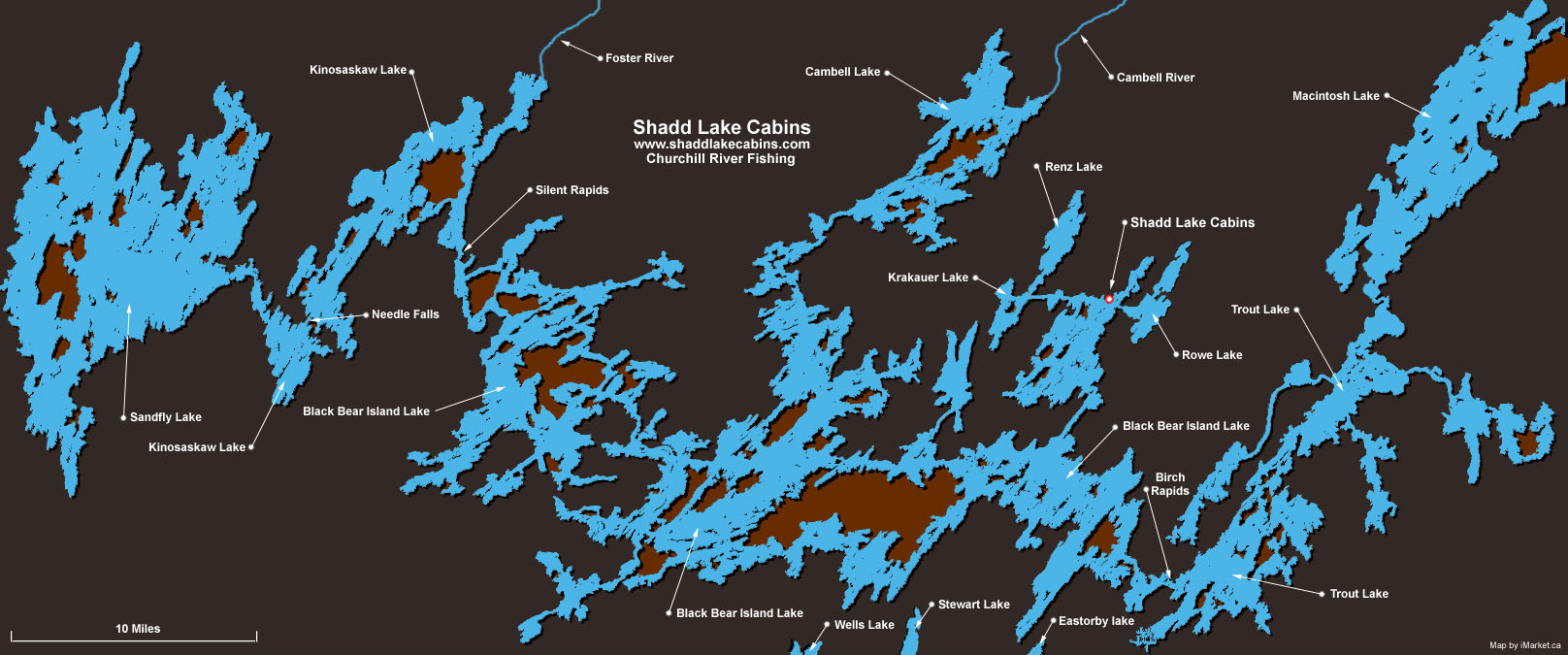
Large map of the Churchill River (below) features the following Lakes:
• Shadd Lake
• Kinoaskaw Lake
• Sandfly Lake
• Black Bear Island Lake
• Needle Falls
• Silent Rapids
• Wells Lake
• Krakauer Lake
• Foster River
• Renz Lake
• Stewart Lake
• Eastorby Lake
• Rowe Lake
• Cambell Lake
• Cambell River
• Birch Rapids
• Trout Lake
• Macintosh Lake
It's just a quick ride from Shadd Lake to the main flow area of the Churchill River where there are hundreds of miles of fish-stuffed water. Walleye and Northern Pike hotspots are too many to count yet our guides seem to know them all.